Making Indian Cities Resilient to Urban Floods
#GS-3 #Disaster Management #Environment #Urban Flooding #Infrastructure #Good Governance
Key takeaways
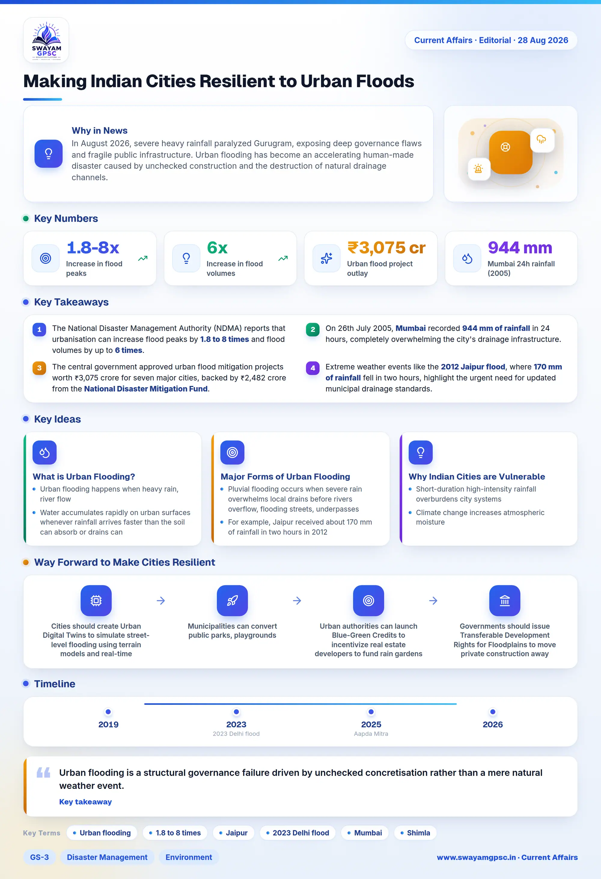
- The National Disaster Management Authority (NDMA) reports that urbanisation can increase flood peaks by 1.8 to 8 times and flood volumes by up to 6 times.
- On 26th July 2005, Mumbai recorded 944 mm of rainfall in 24 hours, completely overwhelming the city's drainage infrastructure.
- The central government approved urban flood mitigation projects worth ₹3,075 crore for seven major cities, backed by ₹2,482 crore from the National Disaster Mitigation Fund.
- Extreme weather events like the 2012 Jaipur flood, where 170 mm of rainfall fell in two hours, highlight the urgent need for updated municipal drainage standards.
Why in News
- In August 2026, severe heavy rainfall paralyzed Gurugram, exposing deep governance flaws and fragile public infrastructure.
- Urban flooding has become an accelerating human-made disaster caused by unchecked construction and the destruction of natural drainage channels.
- This crisis highlights how fragmented governance and weak public planning leave vulnerable populations unprotected during extreme weather events.
What is Urban Flooding?
- Urban flooding happens when heavy rain, river flow, or reservoir releases exceed the capacity of a city's drainage systems.
- Water accumulates rapidly on urban surfaces whenever rainfall arrives faster than the soil can absorb or drains can clear away.
- According to the National Disaster Management Authority (NDMA), built-up urban surfaces increase flood peaks by 1.8 to 8 times and flood volumes by up to 6 times.
- Dense urban concrete prevents rainwater from soaking into the ground, causing severe flooding to develop within minutes.
- Urban flooding is a human-induced disaster that occurs when extreme precipitation meets concretisation, lost natural drains, and poor city management.
- While extreme rainfall serves as the immediate hazard, unplanned urban development creates high exposure and disaster vulnerability.
Major Forms of Urban Flooding
- Pluvial flooding occurs when severe rain overwhelms local drains before rivers overflow, flooding streets, underpasses, and basements.
- For example, Jaipur received about 170 mm of rainfall in two hours in 2012, which completely overwhelmed its municipal drainage network.
- Fluvial flooding happens when rivers overflow into nearby urban areas, as seen during the 2023 Delhi flood along the Yamuna River.
- Coastal flooding strikes cities like Mumbai and Chennai when heavy monsoon rain coincides with high ocean tides and storm surges.
- Flash flooding involves sudden water surges in hilly cities like Shimla and Srinagar, where steep slopes accelerate rapid run-off.
- Reservoir releases cause downstream urban flooding, as demonstrated during the 2015 Chennai floods after releases from the Chembarambakkam reservoir.
- Infrastructure failures like embankment collapses, pump breakdowns, and main breaks can mix dangerous raw sewage directly into standing floodwaters.
- Urban flooding differs from rural flooding because urban floods happen within minutes, affect densely built areas, and destroy major infrastructure.
Why Indian Cities are Vulnerable to Urban Flooding
- Short-duration high-intensity rainfall overburdens city systems, such as when Mumbai recorded 944 mm of rainfall in 24 hours on 26th July 2005.
- Climate change increases atmospheric moisture, causing more frequent extreme precipitation events and cloudbursts across Indian cities.
- Flat topography in cities like Chennai, Kolkata, and Patna creates weak natural slopes, causing prolonged waterlogging during monsoons.
- Urban expansion replaces natural soil with concrete roads, buildings, and pavements, drastically reducing natural groundwater recharge.
- Encroachments and pollution have destroyed urban water bodies, such as the degraded Pallikaranai Marsh in Chennai and lost tanks in Bengaluru.
- Outdated municipal drainage design standards rely on historical weather data without accounting for climate change or compound flood risks.
- Flyovers, railways, and boundary walls act as artificial barriers when planners fail to build adequate cross-drainage culverts.
- Weak adoption of rainwater harvesting systems allows clean roof run-off to spill onto streets instead of recharging underground aquifers.
- Rapid unplanned urban expansion converts natural drainage routes and low-lying floodplains into commercial real estate developments.
- Peri-urban sprawl covers village ponds and natural depressions with concrete long before municipal sanitation services arrive.
- Cities lack updated Digital Elevation Models and flood maps, allowing risky construction in recognized high-risk zones.
- Real estate projects built on filled lakes retain their natural water-holding character, making them highly vulnerable to sudden flooding.
- High concentrations of people, businesses, and digital networks mean even localized waterlogging leads to enormous economic losses.
- Low-income workers, migrants, and vulnerable families suffer the worst impacts due to limited savings, lack of insurance, and poor shelter.
Government Initiatives for Mitigating Urban Flooding
- The NDMA Guidelines on Urban Flooding, 2010 established dedicated Urban Flood Cells and recommended watershed-based drainage planning and pre-monsoon desilting.
- The central government approved projects worth ₹3,075 crore across seven major cities, providing ₹2,482 crore from the National Disaster Mitigation Fund.
- Under AMRUT 2.0, the government funds lake rejuvenation, urban wetland restoration, aquifer recharge, and stormwater drain construction.
- The MoHUA Manual on Storm Water Drainage Systems, 2019 introduced updated technical standards and rainfall-run-off modeling for sustainable urban drainage.
- High-tech forecasting systems like I-FLOWS Mumbai and C-FLOWS Chennai integrate rainfall data, tide levels, and terrain models to predict inundation.
- The IMD deploys Doppler Weather Radars, while the CWC uses FloodWatch India 2.0 to supply real-time flood information seven days in advance.
- Legal framework tools like the Wetlands Rules, 2017 and Coastal Regulation Zone rules protect mangroves and marshes that act as natural buffers.
- The Disaster Management (Amendment) Act, 2025 strengthens city governance through Urban Disaster Management Authorities and community volunteers like Aapda Mitra.
Way Forward to Make Cities Resilient
- Cities should create Urban Digital Twins to simulate street-level flooding using terrain models and real-time weather sensors.
- Municipalities can convert public parks, playgrounds, and parking spaces into temporary water retention basins during severe storms.
- Urban authorities can launch Blue-Green Credits to incentivize real estate developers to fund rain gardens and wetland restoration projects.
- Governments should issue Transferable Development Rights for Floodplains to move private construction away from natural drainage channels voluntarily.
- Local bodies should mandate a Smart Permeability Index for all building permits, tying property tax discounts to sponge features.
- Planning departments must transform regular streets into Sponge Streets using porous pavements, bioswales, and underground storage cells.
- Insurance companies can offer Parametric Flood Insurance to deliver instant automated payouts to informal workers whenever rainfall thresholds are breached.
- Transport departments should link flood prediction models with GPS applications to guide traffic safely away from flooded underpasses during emergencies.
Conclusion
- Urban flooding is a structural governance failure driven by unchecked concretisation rather than a mere natural weather event.
- True resilience requires moving from reactive emergency management to proactive sponge-city planning and ecological restoration.
- Municipalities must ensure equitable investment in public infrastructure so that every citizen receives equal protection during urban disasters.