Five Years of PM GatiShakti National Master Plan
#GS-3 #Economy #Infrastructure #Governance & Social Justice #Good Governance #E-Governance #Current Events #National
Key takeaways
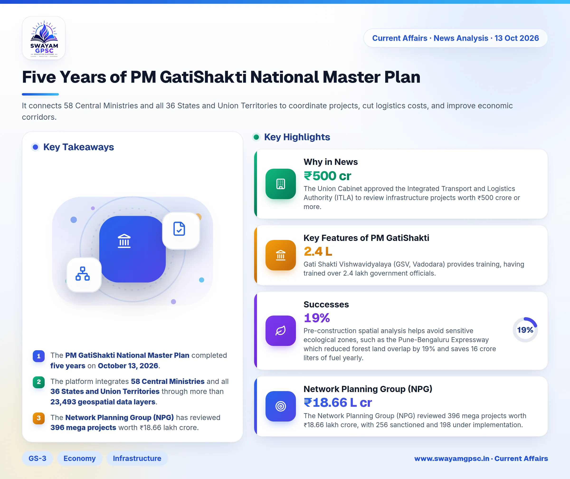
- The PM GatiShakti National Master Plan completed five years on October 13, 2026.
- The platform integrates 58 Central Ministries and all 36 States and Union Territories through more than 23,493 geospatial data layers.
- The Network Planning Group (NPG) has reviewed 396 mega projects worth ₹18.66 lakh crore.
- The initiative aims to reduce national logistics costs from 13 to 14 percent down to 8 to 9 percent of GDP.
Why in News
- The PM GatiShakti National Master Plan completed five years on October 13, 2026.
- The Union Cabinet approved the Integrated Transport and Logistics Authority (ITLA) to review infrastructure projects worth ₹500 crore or more.
About PM GatiShakti Plan
- PM GatiShakti is India’s digital planning framework combining geospatial information systems (GIS), satellite imagery, and cross-ministerial databases.
- It replaces fragmented department planning with an integrated whole-of-government model.
- It connects 58 Central Ministries and all 36 States and Union Territories to coordinate projects, cut logistics costs, and improve economic corridors.
Key Features of PM GatiShakti
- The plan features Seven Core Infrastructure Engines covering roads, railways, ports, waterways, airports, mass transport, and logistics infrastructure.
- It uses a Three-Tier Institutional Mechanism including the Empowered Group of Secretaries (EGoS), the Network Planning Group (NPG), and the Technical Support Unit (TSU).
- The platform houses over 23,493 geospatial data layers on a shared GIS platform managed by BISAG-N.
- It connects digital supply chains using the Unified Logistics Interface Platform (ULIP) through 46 government systems and 142 APIs, alongside the Logistics Data Bank (LDB).
- The Integrated Transport and Logistics Authority (ITLA) runs a 10-year National Transport Master Plan backed by the National Transport Data Repository (NTDR).
- Gati Shakti Vishwavidyalaya (GSV, Vadodara) provides training, having trained over 2.4 lakh government officials.
Successes
- Pre-construction spatial analysis helps avoid sensitive ecological zones, such as the Pune-Bengaluru Expressway which reduced forest land overlap by 19% and saves 16 crore liters of fuel yearly.
- The Network Planning Group (NPG) reviewed 396 mega projects worth ₹18.66 lakh crore, with 256 sanctioned and 198 under implementation.
- Projects like the Jogighopa Multimodal Logistics Park and the Dhubri-Phulbari bridge cut regional transit time from 7 hours to 30 minutes.
- The Ladakh-Haryana 13 GW Green Energy Corridor streamlined clearance across a 480 km High-Voltage Direct Current (HVDC) line.
Challenges
- Incomplete state cadastral maps create mismatches between digital GIS layers and ground realities, causing land acquisition delays.
- Local municipal bodies lag behind central ministries in real-time data updates, leading to repeated utility excavations on newly paved roads.
- Over 30% of critical road and railway delays remain tied up in litigation under the LARR Act despite digital clearances.
- Private logistics park developers face compliance restrictions when trying to integrate their tracking data with ULIP APIs.
- The master plan focuses heavily on major national corridors while often ignoring Gram Panchayat roads and mandi-linkage infrastructure.
Way Forward
- GIS data layers should be upgraded into dynamic 3D Digital Twin models to simulate environmental challenges before construction begins.
- Central infrastructure grants should be linked to the real-time updating of municipal and district revenue maps.
- API access should be expanded for private builders to submit spatial alignment proposals directly to lower consultation costs.
- Monitoring should focus on structural logistics costs, transit turnaround speeds, and container dwell times.
- The planning grid should be extended to the block and village level to connect rural warehouses and rural roads into the national grid.