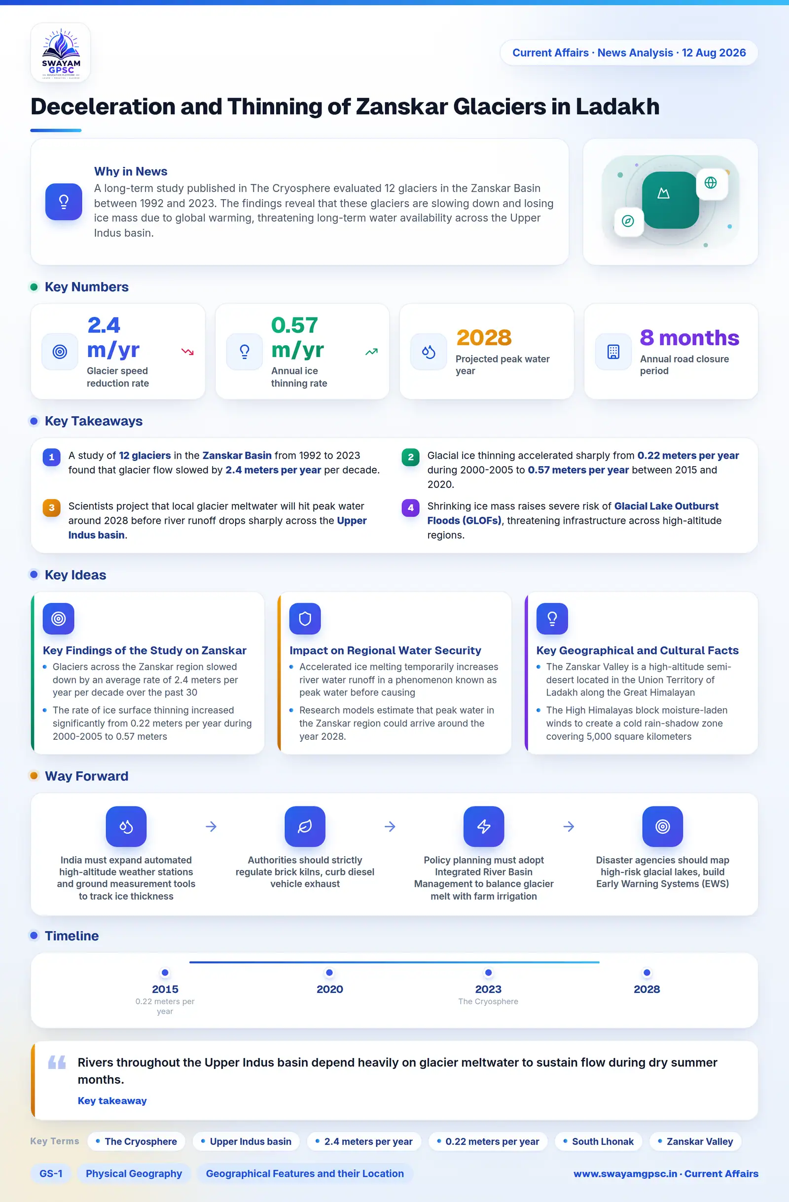
Deceleration and Thinning of Zanskar Glaciers in Ladakh
#GS-1 #Physical Geography #Geographical Features and their Location #GS-3 #Environment #Climate Change #Current Events #National
Key takeaways
- A study of 12 glaciers in the Zanskar Basin from 1992 to 2023 found that glacier flow slowed by 2.4 meters per year per decade.
- Glacial ice thinning accelerated sharply from 0.22 meters per year during 2000-2005 to 0.57 meters per year between 2015 and 2020.
- Scientists project that local glacier meltwater will hit peak water around 2028 before river runoff drops sharply across the Upper Indus basin.
- Shrinking ice mass raises severe risk of Glacial Lake Outburst Floods (GLOFs), threatening infrastructure across high-altitude regions.
Why in News
- A long-term study published in The Cryosphere evaluated 12 glaciers in the Zanskar Basin between 1992 and 2023.
- The findings reveal that these glaciers are slowing down and losing ice mass due to global warming, threatening long-term water availability across the Upper Indus basin.
Key Findings of the Study on Zanskar Glaciers
- Glaciers across the Zanskar region slowed down by an average rate of 2.4 meters per year per decade over the past 30 years.
- The rate of ice surface thinning increased significantly from 0.22 meters per year during 2000-2005 to 0.57 meters per year during 2015-2020.
- Rising global temperatures reduce total glacier mass and make the ice sheet much thinner over time.
- Thinner ice exerts lower driving stress, which directly weakens the glacier's ability to flow down to lower elevation valleys.
- Individual factors like glacier geometry, debris cover, and snout conditions cause each glacier to melt and move at different speeds.
Impact on Regional Water Security and Upper Indus System
- Rivers throughout the Upper Indus basin depend heavily on glacier meltwater to sustain flow during dry summer months.
- Accelerated ice melting temporarily increases river water runoff in a phenomenon known as peak water before causing a sharp decline in flow.
- Research models estimate that peak water in the Zanskar region could arrive around the year 2028.
- Persistent thinning of ice reserves threatens long-term water supplies for agriculture, hydroelectric plants, drinking needs, and ecosystems.
- As glaciers retreat, meltwater collects behind unstable natural walls of loose rock and soil called moraines.
- The sudden collapse of these fragile moraine dams can trigger catastrophic Glacial Lake Outburst Floods (GLOFs), similar to the 2023 South Lhonak flood in Sikkim.
Key Geographical and Cultural Facts About Zanskar Valley
- The Zanskar Valley is a high-altitude semi-desert located in the Union Territory of Ladakh along the Great Himalayan Range.
- The High Himalayas block moisture-laden winds to create a cold rain-shadow zone covering 5,000 square kilometers that preserves traditional Tibetan culture.
- Sitting at an altitude of 4,400 meters, Penzi La Pass acts as the principal mountain highway connecting Zanskar with Kargil and the Suru Valley.
- Unlike steep passes like Zojila, Penzi La forms a wide plateau with glacial lakes, though heavy snowfall cuts off road traffic for 8 months every year.
- During severe winter blockades, local people historically traversed the frozen surface of the Zanskar River, creating the famous Chadar Trek.
- Visible from Penzi La Pass, the Drang-Drung Glacier stands as one of the largest glaciers in Ladakh outside the Karakoram range.
- Originating from the Drang-Drung Glacier, the Doda River flows southeast through the main valley towards Padum.
- The Zanskar River forms at the meeting point of the Doda River and Lungnak River near Padum, then flows through deep canyons to join the Indus River at Nimmu.
- Due to centuries of physical isolation, Zanskar preserves rare social practices such as polyandry in its remote mountain villages.
- Serving as the administrative center of Zanskar, Padum acts as a tourism hub renowned for nearby rock carvings at Gyalwarina.
- Located near Padum, Sani Gonpa features the ancient Kanishka Stupa, linked directly to the 2nd century AD Kushan ruler Kanishka.
- Founded in the 14th century, Karsha Gompa is the largest monastery complex in Zanskar and houses eight historic temples.
- Established in the 11th century by Phagspa Sherab Zangpo, Phugtal Gompa is a famous cave monastery built directly into a cliff wall in the Lungnak valley.
- Perched on a high hill, Stongde Monastery is also known as Marpa Ling and was established by the Tibetan yogi Marpa.
- Built on a steep cliff above the river in the Lungnak valley, Burdan Monastery was founded in the 17th century as a seat of the Drogpa order.
- Situated in the valley, Zangkul Gompa is celebrated as the historic cave retreat of the 10th century AD Indian yogi Naropa.
Way Forward
- India must expand automated high-altitude weather stations and ground measurement tools to track ice thickness and meltwater flow directly.
- Authorities should strictly regulate brick kilns, curb diesel vehicle exhaust, and supply clean cooking gas in mountain districts to reduce black carbon fallout.
- Policy planning must adopt Integrated River Basin Management to balance glacier melt with farm irrigation, power plants, and downstream city needs.
- Disaster agencies should map high-risk glacial lakes, build Early Warning Systems (EWS), and siphon off excess water from rising lakes.
- Governments should support mountain farmers with climate-resilient crops and scale up local structures like Ladakh's Ice Stupas to store winter water for spring crops.