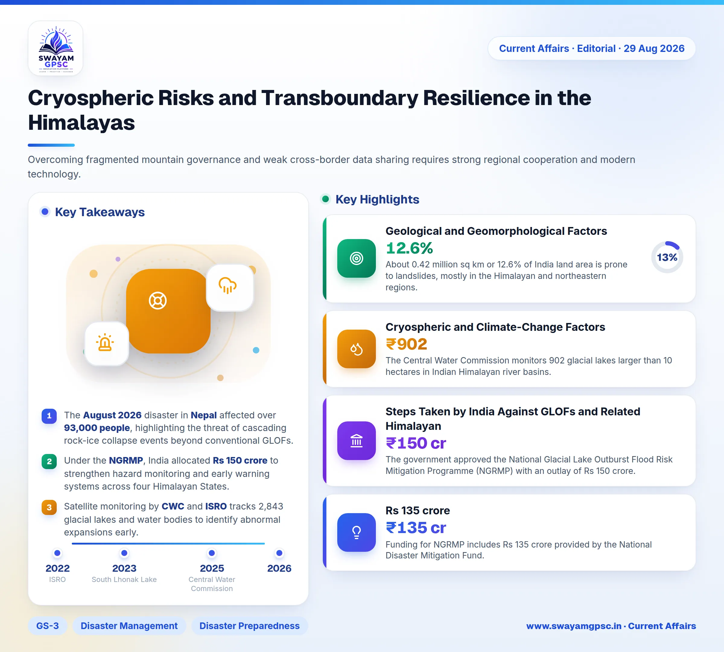
Cryospheric Risks and Transboundary Resilience in the Himalayas
#GS-3 #Disaster Management #Disaster Preparedness #Disaster Response #Environment #Climate Change #Current Events #International
Key takeaways
- The August 2026 disaster in Nepal affected over 93,000 people, highlighting the threat of cascading rock-ice collapse events beyond conventional GLOFs.
- Under the NGRMP, India allocated Rs 150 crore to strengthen hazard monitoring and early warning systems across four Himalayan States.
- Satellite monitoring by CWC and ISRO tracks 2,843 glacial lakes and water bodies to identify abnormal expansions early.
- India approved a Rs 1,000-crore National Landslide Risk Mitigation Project and the Rs 470 crore Yuva Aapda Mitra Scheme to train 2.37 lakh volunteers.
- Transboundary cooperation among India, Nepal, and China is crucial for sharing real-time hydrological data along rivers like the Brahmaputra, Sutlej, and Kosi.
Why in News
- Nepal suffered a severe disaster in August 2026 that affected over 93,000 people requiring urgent humanitarian aid.
- The disaster highlights complex cascading Himalayan risks that go far beyond standard Glacial Lake Outburst Floods (GLOF).
- These transboundary events cross international borders and pose serious threats to the security and infrastructure of India.
- Overcoming fragmented mountain governance and weak cross-border data sharing requires strong regional cooperation and modern technology.
Glacial Lake Outburst Flood (GLOF)
- A Glacial Lake Outburst Flood (GLOF) happens when a lake formed by melting glaciers suddenly releases a massive amount of water downstream.
- This sudden release occurs when the lake natural dam made of ice, moraine, or bedrock fails or gets overtopped by water.
- Glacier retreat accelerates due to rising global temperatures, which enlarges glacial lakes and increases water volume over time.
- Accumulated water volume puts intense hydraulic pressure on natural moraine and ice barriers.
- Triggers like avalanches, landslides, earthquakes, heavy rainfall, or internal erosion can break or destabilize the dam suddenly.
- Dam failure causes a high-velocity wave of water, rocks, ice, and debris that damages downstream settlements and infrastructure.
- The South Lhonak Lake GLOF in 2023 in Sikkim destroyed downstream areas and caused the failure of the Teesta-III hydropower dam.
- The 2013 Kedarnath disaster involved the overflow and moraine failure of Chorabari Lake combined with extreme rainfall.
- The August 2026 Nepal event started with a massive gravitational rock and ice collapse rather than a sudden lake dam breach.
- Ice, rock, mud, water, and trees moved together as a debris flow during the Nepal event, unlike pure water release in conventional GLOFs.
- Recent scientific evidence suggests describing the Nepal event as a glacier or rock-ice collapse-triggered debris flood.
- Disaster management in the Himalayas must monitor all cascading cryospheric hazards instead of focusing only on existing glacial lakes.
Geological and Geomorphological Factors
- The Himalayas are young fold mountains formed by the ongoing collision of the Indian and Eurasian tectonic plates.
- Rocks in this region are highly folded, fractured, and weathered, making mountain slopes naturally unstable and prone to landslides.
- Northward movement of the Indian Plate builds tectonic stress along the Main Central Thrust, Main Boundary Thrust, and Himalayan Frontal Thrust.
- Loose materials like glacial deposits, moraine, and river sediments easily fail under heavy rainfall, snowmelt, or earthquakes.
- About 0.42 million sq km or 12.6% of India land area is prone to landslides, mostly in the Himalayan and northeastern regions.
- ISRO Landslide Atlas documented nearly 80,000 landslides between 1998 and 2022.
Climatic and Hydrological Factors
- Moist monsoon winds hit mountain slopes and rise rapidly, producing heavy rainfall on windward sides.
- High rainfall increases surface runoff, soil erosion, and slope saturation in narrow mountain valleys.
- Cloudbursts cause intense short-duration rainfall that triggered the 2013 Kedarnath disaster and major floods in Himachal Pradesh and Uttarakhand.
- Changing monsoon patterns bring longer dry periods followed by short spells of extreme rain, reducing soil stability.
- Rivers carry heavy sediment loads that raise riverbeds and create temporary landslide dams that can burst suddenly.
Cryospheric and Climate-Change Factors
- Rapid warming at high altitudes accelerates glacier retreat, permafrost thaw, and snowmelt.
- Melting glaciers leave behind depressions that fill with water to form high-risk glacial lakes.
- The Central Water Commission monitors 902 glacial lakes larger than 10 hectares in Indian Himalayan river basins.
- Thawing permafrost degrades the natural ice binder in mountain rocks, triggering rockfalls like the 2021 Chamoli avalanche disaster.
Anthropogenic Factors
- Unscientific road cutting and vertical excavations disrupt slope balance, causing frequent landslides along the Char Dham routes.
- Hydropower projects involving dams, tunnels, and blasting alter river channels and amplify downstream flood damage.
- Hydropower damage caused severe downstream destruction during the 2021 Chamoli and 2023 Sikkim disasters.
- Unplanned urban expansion onto unstable slopes and floodplains led to severe land subsidence in Joshimath in 2023.
- Excessive seasonal tourism in towns like Shimla, Manali, and Mussoorie strains local emergency systems and infrastructure.
Governance and Socio-Economic Factors
- Mountain governance is fragmented across separate agencies handling roads, forests, rivers, and disaster management without unified planning.
- Harsh weather and difficult terrain limit real-time monitoring instruments like automatic weather stations and lake sensors.
- Transboundary rivers and lakes across India, Nepal, Bhutan, China, and Pakistan suffer from inadequate real-time data sharing.
- Projects undergo separate environmental assessments, ignoring the cumulative ecological stress on river basins.
Cascading and Compound Nature of Himalayan Disasters
- Earthquakes can trigger thousands of landslides, block river channels, and form fragile lakes that later burst into flash floods.
- Extreme rainfall saturates soil, triggers landslides, blocks drainage channels, and leads to destructive debris floods.
- Ice or rock avalanches falling into glacial lakes create large displacement waves that overtop dams and release GLOFs.
Steps Taken by India Against GLOFs and Related Himalayan Hazards
- The government approved the National Glacial Lake Outburst Flood Risk Mitigation Programme (NGRMP) with an outlay of Rs 150 crore.
- Funding for NGRMP includes Rs 135 crore provided by the National Disaster Mitigation Fund.
- Satellite monitoring by Central Water Commission and ISRO expanded in 2025 to cover 2,843 glacial lakes and water bodies, including 2,485 glacial lakes.
- Early warning infrastructure includes automatic weather stations, water level sensors, remote cameras, and sirens.
- Following the 2023 South Lhonak GLOF, Sikkim conducted bathymetric surveys and created community evacuation protocols.
- NDMA issued Guidelines on Management of GLOFs, 2020 covering hazard zonation, lake monitoring, controlled drainage, and post-disaster recovery.
- The Dam Safety Act, 2021 and Central Water Commission mandate GLOF studies and dam-break analysis for new dams near glacial lakes.
- A Rs 1,000-crore National Landslide Risk Mitigation Project was approved for 15 landslide-prone States.
- The Ministry of Jal Shakti established the Centre for Cryosphere and Climate Change Studies at NIH-Roorkee in 2023.
- A glacier monitoring committee involving CWC, GSI, ISRO, and IMD coordinates research under the National Institute of Hydrology.
- The Yuva Aapda Mitra Scheme with an outlay of Rs 470 crore aims to train 2.37 lakh volunteers across 315 disaster-prone districts.
Why International Cooperation is Necessary
- Transboundary hazards cross borders quickly, such as the 1981 Zhangzangbo GLOF in Tibet which destroyed Nepal infrastructure downstream.
- Downstream countries need real-time data on rainfall, river discharge, and lake levels from upstream nations.
- India relies on China for hydrological data from the Brahmaputra and Sutlej upper basins to prevent flood damage.
- Flood warning arrangements for the Kosi, Gandak, and Karnali basins in Nepal help protect vulnerable areas in Bihar.
- The 2008 Kosi disaster happened after an embankment breach near Kusaha in Nepal flooded vast regions of Bihar.
- Shared monitoring of high-risk glacial lakes near remote borders is essential, as shown by the 2016 Bhote Koshi flood.
- Automated real-time early warning systems between neighboring nations, like existing flood data sharing between Bhutan and Assam, save downstream lives.
- Compound disaster sequences following events like the 2015 Nepal earthquake require joint regional mitigation strategies.
- Regional emergency response mechanisms enable swift assistance, as demonstrated by India Operation Maitri after the 2015 Nepal earthquake.
- Combining scientific capabilities across China, India, Nepal, Bhutan, and Bangladesh improves overall regional disaster resilience.
- Transparent data sharing reduces geopolitical mistrust and clarifies whether sudden floods stem from natural causes or dam releases.
Way Forward
- Create a Himalayan Digital Twin using virtual basin models and real-time data to simulate GLOFs and debris flows.
- Build a Cryosphere IoT Network with solar-powered sensors on glacial lakes to trigger automatic village sirens during danger.
- Deploy AI-Based Forecasting across satellite, seismic, and weather data to detect early signs of rock-ice avalanches.
- Establish a Himalayan Disaster Data Grid connecting ISRO, IMD, CWC, GSI, and NDMA for rapid warning dissemination.
- Implement Smart Tourist Tracking with location-enabled digital passes to restrict movement into high-risk disaster zones.
- Create Drone-Based Emergency Corridors to deliver medical supplies and restore communication when transport links fail.
- Introduce Parametric Disaster Insurance that pays out automatically when rainfall or water levels cross safety thresholds.
- Set up Community Living Laboratories where scientists and locals test resilient housing and traditional early warning models.
Conclusion
- Escalating cryospheric changes and steep mountain terrain require moving beyond narrow lake-centric GLOF monitoring.
- India must address remaining gaps in last-mile warning delivery and cross-border hydrological data sharing.
- Transcending geopolitical rivalries among India, Nepal, and China is vital for establishing shared early-warning systems across the Himalayas.