India-China Border Management and Strategic Challenges
#GS-2 #Governance & Social Justice #Current Events #National #International #Line of Actual Control #India-China Border #Vibrant Villages Programme #Infrastructure
Key takeaways
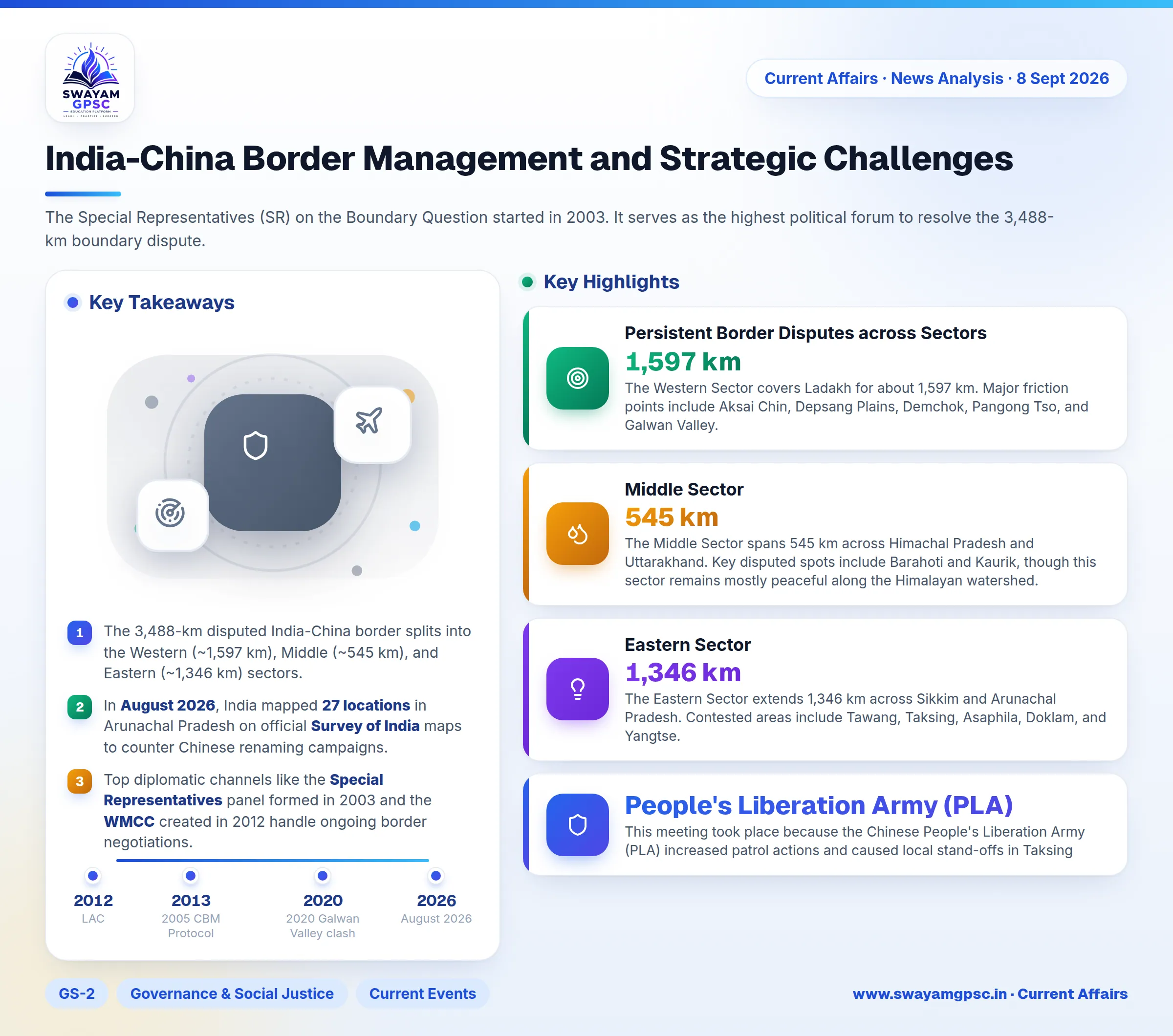
- The 3,488-km disputed India-China border splits into the Western (~1,597 km), Middle (~545 km), and Eastern (~1,346 km) sectors.
- In August 2026, India mapped 27 locations in Arunachal Pradesh on official Survey of India maps to counter Chinese renaming campaigns.
- Top diplomatic channels like the Special Representatives panel formed in 2003 and the WMCC created in 2012 handle ongoing border negotiations.
- Strategic infrastructure projects such as the Arunachal Frontier Highway (NH-913), Sela Tunnel, and Nechiphu Tunnel provide all-weather border access.
- Following the 2020 Galwan clash, India deployed Rafale aircraft, S-400 systems, and BrahMos missiles along northern command areas.
Why in News
- India and China conducted their first military talks at the Corps Commander level in the Eastern Sector. The meeting occurred at the Wacha-Damai Border Personnel Meeting (BPM) Point in Arunachal Pradesh.
- This meeting took place because the Chinese People's Liberation Army (PLA) increased patrol actions and caused local stand-offs in Taksing, located in the Upper Subansiri district of Arunachal Pradesh.
- This shift expands high-level military discussions beyond Ladakh. It brings renewed attention to overall border management along the Line of Actual Control (LAC).
Overview of Border Management Dynamics
- Border management between India and China is shifting toward formal deterrence and military dialogue. Both nations use new regional talks, military deployments, and local communication channels to avoid conflict.
- Unresolved disputes across Arunachal Pradesh, Aksai Chin, and other border points require India to combine strategic infrastructure, civilian border settlement, economic safeguards, and international partnerships.
Mechanisms for Managing the Border Dispute
- The Special Representatives (SR) on the Boundary Question started in 2003. It serves as the highest political forum to resolve the 3,488-km boundary dispute.
- The Working Mechanism for Consultation and Coordination (WMCC) began in 2012. It handles diplomatic and military talks to maintain peace along the LAC, though it cannot resolve final boundary lines.
- Military leaders hold Corps Commander-Level Meetings during major stand-offs to create buffer zones and manage tactical troop disengagement.
- commanders use Border Personnel Meeting (BPM) Points along the LAC to resolve local ground issues directly.
- Direct Institutional Hotlines connect regional military commands so officers can resolve misunderstandings before troops escalate friction.
- Four major agreements guide peace efforts: the 1993 Maintenance of Peace and Tranquillity Agreement, the 1996 Confidence-Building Measures Agreement, the 2005 CBM Protocol, and the 2013 Border Defence Cooperation Agreement (BDCA).
Persistent Border Disputes across Sectors
- The Western Sector covers Ladakh for about 1,597 km. Major friction points include Aksai Chin, Depsang Plains, Demchok, Pangong Tso, and Galwan Valley. India relies on the Johnson Line (1865) while China claims land based on the MacDonald Line (1893).
- The Middle Sector spans 545 km across Himachal Pradesh and Uttarakhand. Key disputed spots include Barahoti and Kaurik, though this sector remains mostly peaceful along the Himalayan watershed.
- The Eastern Sector extends 1,346 km across Sikkim and Arunachal Pradesh. Contested areas include Tawang, Taksing, Asaphila, Doklam, and Yangtse. India follows the McMahon Line (1914), but China rejects this line and calls Arunachal Pradesh South Tibet (Zangnan).
Structural Drivers of Conflict
- The two countries have not agreed on standard physical maps. This lack of clear demarcation leads to overlapping patrol routes and territorial claims.
- China built advanced transport links across the Tibetan Plateau, including the Lhasa-Nyingchi railway. These roads and airfields allow Chinese forces to move troops faster than Indian forces.
- China constructed dual-use border villages called Xiaokang near the LAC. These settlements combine civilian housing with military supply posts to strengthen territorial claims.
- China attempts to rename local sites in Arunachal Pradesh to enforce its claim over the region. India rejects these naming actions.
- In August 2026, India formally listed 27 locations in Arunachal Pradesh on official Survey of India maps to counter Chinese renaming attempts.
Strategic Significance of the Eastern Sector
- The Doklam tri-junction sits near the Siliguri Corridor. This narrow strip connects mainland India to the northeastern states, making military stability here vital for national security.
- Positions at Tawang and Bum La give Indian forces superior vantage points overlooking the Assam plains.
- Tawang holds historical importance for Tibetan Buddhism because it houses the historic Tawang Monastery. This gives the area unique cultural significance.
- Maintaining strong positions in Arunachal Pradesh protects India's territorial sovereign authority against Chinese claims.
- The Yarlung Tsangpo-Siang-Brahmaputra water system flows through this region. Controlling these areas guarantees downstream water security for India.
- A secure northeastern border supports India's Act East Policy by building safe trade paths toward Southeast Asia.
Measures Taken by India
- Following the 2020 Galwan Valley clash, India moved military units closer to northern borders. The military deployed Rafale fighter jets, S-400 air defence batteries, and BrahMos missiles for faster response capabilities.
- India is constructing all-weather access roads near the LAC. Major projects include the Arunachal Frontier Highway (NH-913), Sela Tunnel, and Nechiphu Tunnel to speed up troop movements.
- The government started the Vibrant Villages Programme (VVP) to develop frontier towns. Improving local jobs and living conditions stops outward migration and maintains a civilian presence.
- India modified foreign investment rules under Press Note 3 (2020). In 2026, authorities relaxed these rules slightly to allow restricted foreign investments while keeping tight security oversight.
- India deepened strategic coordination through the Quad grouping with the US, Japan, and Australia. This boosts security cooperation across the region without entering a military treaty.
Frequently Asked Questions
- The 3,488-km India-China border divides into three parts: the Western Sector in Ladakh, the Middle Sector in Himachal Pradesh and Uttarakhand, and the Eastern Sector in Sikkim and Arunachal Pradesh.
- The Special Representatives mechanism created in 2003 serves as the top diplomatic channel to negotiate a final settlement to the border dispute.
- The WMCC, formed in 2012, coordinates tactical military and diplomatic steps along the border without taking up final boundary ownership decisions.
- Tawang provides tactical defensive height over the Assam valley, protects water security, and safeguards key Tibetan Buddhist heritage sites.
- The Vibrant Villages Programme funds border town infrastructure to keep local residents in place, creating a strong demographic presence along sensitive frontier boundaries.