Assam Floods and Flood Management Challenges in India
#GS-2 #GS-3 #Governance & Social Justice #Disaster Management #Environment #Government Policies & Interventions #Assam Floods #Flood Management #Climate Change
Why in News
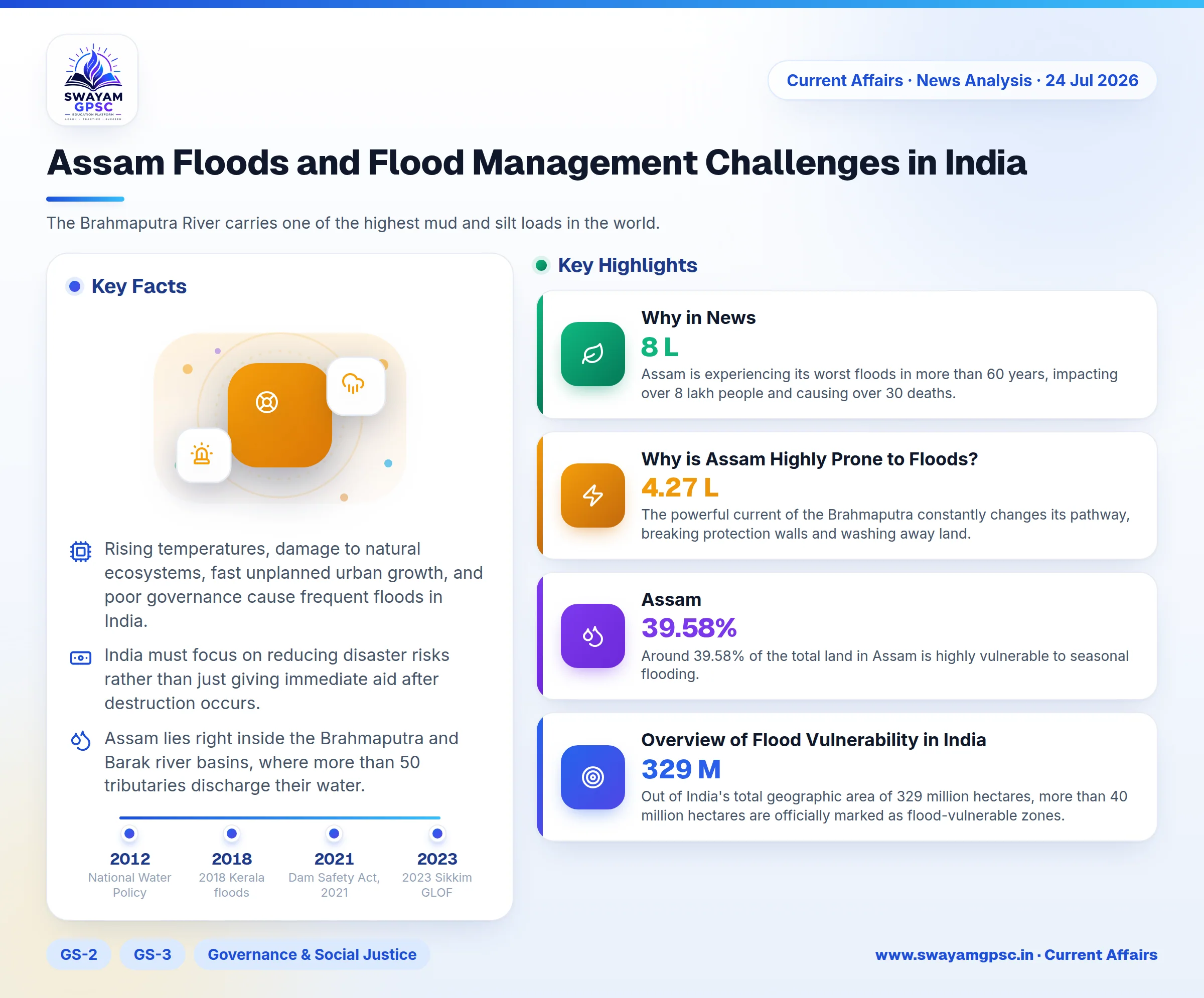
- Assam is experiencing its worst floods in more than 60 years, impacting over 8 lakh people and causing over 30 deaths. This disaster shows major weaknesses in India's flood management systems and underscores the urgent need for climate-resilient infrastructure.
Summary
- Rising temperatures, damage to natural ecosystems, fast unplanned urban growth, and poor governance cause frequent floods in India. These problems expose deep weaknesses in water level forecasting, dam operations, sharing of data between states, and overall disaster readiness.
- India must focus on reducing disaster risks rather than just giving immediate aid after destruction occurs. Achieving this goal requires unified river basin planning, modern technology for early alerts, scientific control of dams, strict rules for riverbank building, and better agency coordination.
Why is Assam Highly Prone to Floods?
- Assam lies right inside the Brahmaputra and Barak river basins, where more than 50 tributaries discharge their water. This low-lying flat terrain makes the state naturally helpless against frequent flooding during the monsoon season.
- The Brahmaputra River carries one of the highest mud and silt loads in the world. When it flows into the flat plains of Assam, the water slows down, depositing silt that raises the riverbed and forces water over the banks.
- Heavy rainfall during the Southwest Monsoon brings vast amounts of water into the region. At the same time, massive water flow comes down from hilly neighbor states like Arunachal Pradesh and Meghalaya, causing sudden flash floods.
- The powerful current of the Brahmaputra constantly changes its pathway, breaking protection walls and washing away land. Since the year 1950, the river has permanently swept away roughly 4.27 lakh hectares of fertile land in Assam.
- Cutting down trees in hilly upstream forests causes heavy topsoil erosion. This loose soil washes down into the main river, filling its bed with mud and drastically lowering its capacity to store water.
- Global climate change is causing unpredictable, high-intensity cloudbursts and heavy rain spells. These sudden downpours create higher water levels, making annual floods much more destructive than before.
- Local authorities have built earthen walls along riverbanks for protection, but most of these structures are very old. They often collapse under strong water currents because they were not built to handle such massive flows.
- Around 39.58% of the total land in Assam is highly vulnerable to seasonal flooding. This proportion is nearly four times the national average, turning every monsoon season into a severe public safety test.
Overview of Flood Vulnerability in India
- Out of India's total geographic area of 329 million hectares, more than 40 million hectares are officially marked as flood-vulnerable zones.
- Every single year, rising waters submerge about 75 lakh hectares of land and take around 1,600 human lives, with severe, widespread floods striking more than once every five years.
- Areas that never faced high water problems in the past are now regularly experiencing heavy flooding during the monsoon.
Natural Causes of Floods
- India receives almost 75% to 80% of its total annual rain in just four months during the Southwest Monsoon between June and September.
- When huge amounts of rain fall in a short window, rivers and local storm drains cannot clear the water fast enough, leading to massive overbank flows.
- Major northern rivers like the Ganga and Brahmaputra originate in the young Himalayas and carry gigantic quantities of loose rock and sand down to the plains.
- As mud settles on the riverbed over time, the river channel becomes shallow and holds less water, forcing rivers to overflow during heavy rain.
- Rivers heavily choked with sediment frequently twist, turn, and break into new paths across the landscape.
- For instance, the Kosi River, often called the Sorrow of Bihar, has shifted its path multiple times over the decades, drowning completely new towns and farmland.
- Higher global temperatures are melting Himalayan glaciers faster, creating large high-altitude lakes that can burst without warning, as seen during the 2023 Sikkim GLOF disaster.
- Severe tropical storms forming in the Bay of Bengal bring heavy rain and push sea waves inland, while seawater surges block rivers from freely emptying into the ocean.
Human-Made Causes of Floods
- Cutting down trees across mountain ranges like the Himalayas and Western Ghats stops soil from absorbing water, increasing surface runoff and choking rivers with mud.
- Since the year 1954, India has constructed more than 34,000 km of artificial earthen embankments along its major river channels.
- Relying solely on wall barriers traps silt inside the riverbed, causing it to rise faster; when these walls eventually collapse, they release devastating flash floods onto nearby towns.
- Dam managers often fail to follow mandated water level rules, keeping reservoirs full for power generation until heavy rain forces sudden water releases, as happened during the 2018 Kerala floods.
- Illegal building activity along riverbanks and the loss of natural water storage sites, like Assam's Beels, prevent river basins from safely absorbing floodwaters.
- Illegal and uncontrolled mining of river sand alters the natural shape of riverbeds, damages riverbanks, and turns peaceful water flows into unpredictable floods.
Urban Flooding Issues
- Uncontrolled expansion of cities covers green ground with concrete and asphalt, preventing rainwater from soaking into the soil and causing immediate surface water runoff.
- Building over urban lakes and natural rainwater channels deprives cities of natural sponges, leading to urban submergence in major hubs like Bengaluru and Chennai.
- Old storm drainage networks choked with plastic rubbish and construction waste cannot quickly carry away high volumes of rainwater during intense rain events.
- Frequent spells of extremely intense rainfall within short timeframes easily overwhelm municipal drainage infrastructure, creating severe citywide flash floods.
Structural Flood Management Measures
- Government agencies have built over 34,000 km of river protective walls, dug drainage channels, and elevated vulnerable village platforms to safeguard rural populations.
- Parliament passed the Dam Safety Act, 2021 to set up a nationwide legal framework for regular inspection, safe operation, and structural upkeep of large dams.
- Dam authorities follow predefined water capacity limits called Rule Curves to keep empty buffer storage during monsoon months, preventing sudden overflows.
- Formulated back in the year 1980, the National Perspective Plan proposes connecting surplus river basins with dry regions to redistribute floodwaters productively.
Non-Structural Flood Management Measures
- To prevent risky construction near rivers, the Central Water Commission (CWC) introduced the Model Flood Plain Zoning Bill (1975) to guide state building regulations.
- The Central Water Commission (CWC) runs a countrywide forecasting network that uses automatic sensors, computer models, and satellite maps to alert communities early.
- Authorities plant trees, build check dams, and conserve soil across river catchment hills to reduce topsoil washing into riverbeds.
- Emergency agencies organize safety drills, community training, and local action plans to help vulnerable villagers react swiftly during sudden flood warnings.
Institutional and Policy Framework
- The Disaster Management Act, 2005 created a structured command framework including the National Disaster Management Authority (NDMA) and specialized response teams like the NDRF.
- Managed by the Ministry of Jal Shakti, the Flood Management and Border Areas Programme (FMBAP) offers central financial support for local flood control and riverbank protection.
- The official National Water Policy, 2012 highlights the importance of managing entire river basins holistically while restoring natural wetland drainage networks.
- The India Meteorological Department (IMD) issues precise, location-specific storm warnings to help district officials evacuate residents before severe weather hits.
Concerns Regarding India's Flood Management
- Under the Constitution, Entry 17 of the State List grants states authority over local water works, while Entry 56 of the Union List gives the Central Government control over inter-state rivers.
- This legal division creates conflicts between neighboring states, as upstream regions hold water back for electricity generation without considering flood risks downstream.
- Although India passed the River Boards Act, 1956 long ago, the government has failed to set up active river basin bodies to manage shared water resources cleanly.
- Official audits conducted by the Comptroller and Auditor General (CAG) highlighted major financial mismanagement and slow implementation within the Flood Management Programme (FMP).
- Long administrative delays in passing Detailed Project Reports (DPRs) mean engineering designs become completely outdated before construction work even starts.
- Central funding delays combined with state governments misusing flood relief money leave crucial river defense walls unfinished year after year.
- Modernizing flood response remains difficult because hydrological monitoring equipment across rural river stations is outdated or broken.
- Many automated water sensors set up by the Central Water Commission (CWC) do not work properly due to lack of maintenance, calibration failures, or physical destruction.
- When water measurement data arrives late or contains errors, disaster managers lose precious time needed to safely evacuate citizens from danger zones.
- International water treaties like the Indus Waters Treaty (1960) only cover basic water sharing, ignoring climate change risks, melting glaciers, and flood prevention.
- India relies on temporary agreements with China for upstream Brahmaputra water data, leaving northeastern states vulnerable to unannounced water releases from Tibet.
- Dam supervisors routinely ignore safety limits set by Rule Curves to hoard water for farming and power, forcing sudden massive releases during heavy monsoons.
- Despite the enactment of the Dam Safety Act, 2021, many large dams still operate without mandatory Emergency Action Plans (EAPs) or clear public alarm warning systems.
- Local government offices lack proper funding and specialized emergency tools, making grassroots disaster management weak across rural regions.
- State governments fail to fund their State Disaster Response Forces (SDRFs) adequately, leaving rescue units short of modern boats, life jackets, and communication gear.
- Because local response setups are weak, states constantly rely on the central National Disaster Response Force (NDRF) to conduct rescue work after disaster strikes.
- Northeast India faces severe constraints due to its fragile mountain ecology and complex river systems that cross international borders.
- Major northeast rivers originate inside China and Bhutan, limiting Indian authorities' ability to control upstream river surges or collect timely flow data.
- Lack of international data sharing combined with rough terrain, weak roads, and poor forecasting networks repeatedly causes heavy destruction of local lives, wildlife, and vital public infrastructure.
Measures Can Strengthen India's Flood Management
- Government bodies must implement the Rashtriya Barh Ayog (1980) guidelines, which advise against building continuous river walls and favor building raised houses and growing flood-tolerant crops.
- The R. Rangachari Committee (2003) emphasized moving from trying to block floods to managing them through Integrated River Basin Management (IRBM) and active local community participation.
- Following the NITI Aayog Committee on Flood Management (2021), dam managers should maintain empty reservoir buffers, build a National Water Model (NWM), and deploy modern forecasting tools.
- Authorities must align policy with the Sendai Framework (2015-2030) by investing in durable infrastructure and disaster prevention under the Build Back Better principle instead of just issuing post-disaster relief funds.
- The Central Government should offer financial rewards to persuade states to enforce the Model Flood Plain Zoning Bill (1975), strictly stopping illegal buildings on natural waterways.
- India should establish active River Basin Organizations (RBOs) to coordinate dam releases, manage river sediment, and share live flow data between neighboring states.
- Emergency agencies should deploy AI-based Early Warning Systems (EWS), smart IoT sensors on river dams, and satellite flood maps to modernise the CWC forecasting network.
- Cities should adopt 'Room for the River' concepts and Sponge City designs, reviving local lakes and creating green open spaces to absorb excess rainwater naturally.
- Building multipurpose dams on flood-prone rivers like the Kosi and Mahanadi as part of Interlinking of Rivers (ILR) projects can capture heavy monsoon runoffs safely.
- While river interlinking helps store excess water, it cannot stop all floods on its own and must be backed by strict floodplain rules and high-tech warning systems.
Way Forward
- Annual flooding across India is no longer just a natural seasonal event; climate change and poorly planned urbanization have turned it into a major economic crisis.
- Protecting citizens requires moving beyond temporary earthen walls and routine post-disaster payout checks.
- Building lasting flood resilience requires restoring natural wetlands, strictly enforcing riverbank building rules, and leveraging modern forecasting technology.
Frequently Asked Questions (FAQs)
- The Flood Management and Border Areas Programme (FMBAP) is a Ministry of Jal Shakti initiative that provides financial aid for flood control, riverbank anti-erosion works, and coastal protection.
- The Dam Safety Act, 2021 provides a legal framework for the regular inspection, operational surveillance, and maintenance of specified dams to reduce catastrophic flood risks.
- Based on the Model Flood Plain Zoning Bill (1975), flood plain zoning regulates construction in flood-prone areas to reduce property damage and protect natural river channels.
- Integrated River Basin Management (IRBM) ensures coordinated reservoir operation, sediment control, and data sharing across entire river basins, resolving inter-state conflicts and enhancing flood resilience.